Excursión Senderismo Les Plantiers - Sentier du Rocher de l'Aigle - Photo

Sentier du Rocher de l'Aigle

 tracegps
tracegps

Usuario

© OpenStreetMap contributors
Longitud
Longitud
4,2 km
Altitud máxima
Altitud máxima
1144 m
Desnivel positivo
Desnivel positivo
241 m
Km-Effort
Km-Effort  
7,5 km
Altitud mínima
Altitud mínima
890 m
Desnivel negativo
Desnivel negativo
246 m
Boucle
Boucle
Fecha de creación :
2014-12-10 00:00:00.0
Última modificación :
2014-12-10 00:00:00.0

(0 Opinión)

Senderismo
Senderismo
3h00
Dificultad : Medio

Escanee este código QR para abrir la excursión en la aplicación SityTrail

Aplicación GPS de excursión GRATIS

Logo SityTrail SityTrail

IGN / Institutos geográficos

Descargar SityTrail en App Store Descargar SityTrail en Google Play

Logo SityTrail SityTrail World

El mundo es suyo

Descargar SityTrail en App Store Descargar SityTrail en Google Play Descargar SityTrail en Huawei AppGallery

A propósito

Ruta Senderismo de 4,2 km a descubrir en Occitania, Gard, Les Plantiers. Esta ruta ha sido propuesta por tracegps.

Descripción

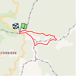
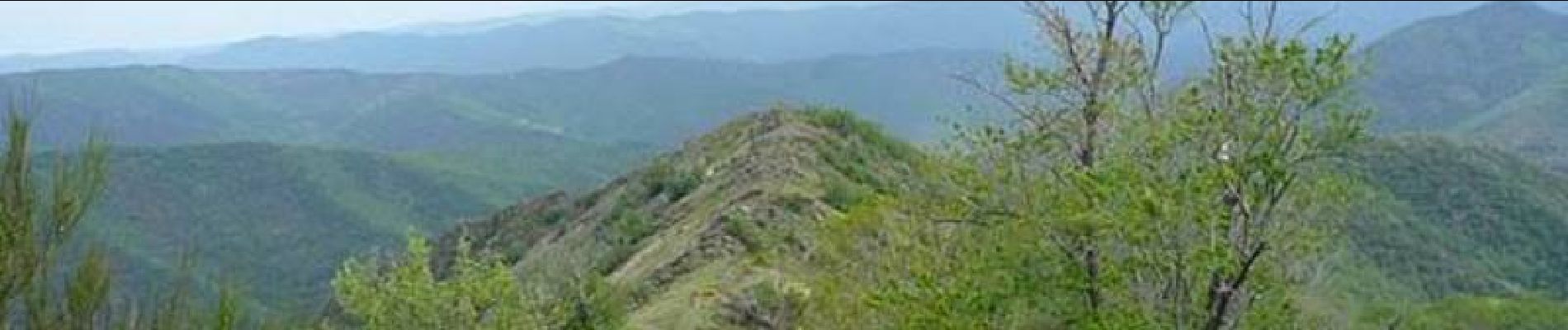
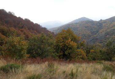
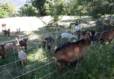
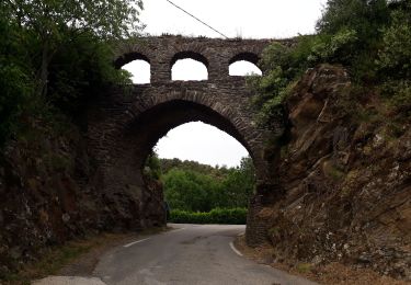
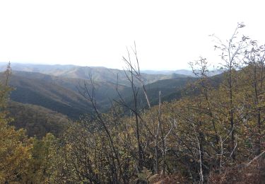
Circuit proposé par l'Office de Tourisme de la Vallée Borgne. La randonnée du Rocher de l'Aigle offre un point de vue saisissant sur la vallée Borgne et au-delà. Par beau temps, le regard monte de la mer jusqu'au mont Lozère et aux pré-Alpes provençales. La forêt, domaniale, permet aussi de comprendre l'impact des politiques de reboisement engagées à la fin du XIX e Siècle. Départ du pont du col de l'Asclier. La pochette de 15 circuits balisés est en vente (5€) à l’Office de Tourisme de la Vallée Borgne. L’Office de Tourisme est ouvert toute l'année. Vous trouverez sur place de quoi se restaurer et dormir.

Perfil altimétrico

Fotos

Localización

País:
France
Región :
Occitania
Departamento/provincia :
Gard
Municipio :
Les Plantiers
Localidad:
Unknown
Salida:(Dec)
Salida:(UTM)
559600 ; 4880780 (31T) N.

Excursiones cerca

Excursión Senderismo Les Plantiers - Sentier de Saint Marcel de Fontfouillouse -  Les Plantiers - Photo
Senderismo
tracegps

Senderismo

Muy difícil
(1)
Les Plantiers, Occitania, Gard, France
13,6 km | 21 km-effort
4h 0min
Excursión Senderismo Les Plantiers - Vallée Borgne - Photo
Senderismo
GUIDE
nadinebondoux

Senderismo

Difícil
Les Plantiers, Occitania, Gard, France
19,7 km | 32 km-effort
5h 19min
Excursión Senderismo Saumane - Exil / pont des chèvres  - Photo
Senderismo
GUIDE
nadinebondoux

Senderismo

Difícil
Saumane, Occitania, Gard, France
17,3 km | 27 km-effort
5h 53min
Excursión Senderismo Les Plantiers - vallée Borgne - Photo
Senderismo
GUIDE
nadinebondoux

Senderismo

Difícil
Les Plantiers, Occitania, Gard, France
25 km | 36 km-effort
6h 15min
Excursión Senderismo Les Plantiers - Les Plantiers et st Marcel de Fontfouillouse - Photo
Senderismo
GUIDE
randotines

Senderismo

Difícil
(1)
Les Plantiers, Occitania, Gard, France
13,6 km | 21 km-effort
4h 33min
Excursión Senderismo Les Plantiers - Sentier du Mouflon - Les Plantiers  - Photo
Senderismo
GUIDE
randotines

Senderismo

Difícil
Les Plantiers, Occitania, Gard, France
11,2 km | 18,6 km-effort
3h 30min
Excursión Senderismo L'Estréchure - sentier du soult -  - Photo
Senderismo
campingmasdelacam

Senderismo

Difícil
L'Estréchure, Occitania, Gard, France
10,3 km | 17,1 km-effort
3h 52min
Excursión Senderismo Saint-Martial - Montagne du Liron au départ de St Martial - Photo
Senderismo
GUIDE
nadinebondoux

Senderismo

Difícil
Saint-Martial, Occitania, Gard, France
19,4 km | 32 km-effort
7h 4min
Excursión A pie Les Plantiers - Sentier de Fontfouillouse - Photo
A pie
PRO

A pie

Fácil
Les Plantiers, Occitania, Gard, France
9,2 km | 15,2 km-effort
3h 27min
No


Cerrar
Mis suscripciones